Friday, 22 April 2011

Day 45 Karijini National Park - 13/4/11

We set off this morning from Tom Price to go to Dales campground in Karijini National Park.  It was bitumen all the way until we got to the campground.  During the winter months, there is a host ranger on site where you can pay your fees which is just $7 per person per night.  There is no water or electricity but there are gas barbecues and drop toilets.  The sites are in "loops" a circular track with sites marked out.  One of the loops is for generators, one for tour operators and the rest being for caravans, campers, tents etc.  You also have to take your rubbish out with you as there is no collection.  We decided not to use the generator and just run the lights off the battery in the van and the fridge and stove are gas.  The shower also runs off the battery for the pump and the water heater is gas.

Driving into Karijini National Park 
Our site at Dales Campground

It was only 105kms from Tom Price so we got there early. Once we had set up we went for a drive and walk to Circular Pool which is an amazing pool at the bottom of a big gorge and then to Fortescue Falls which you  see from the top or you can descend a steep trail from the carpark.  Back to the van for lunch and then in the afternoon we set off to explore the gorges.
Circular Pool
The map of Forescue Falls showing different walks you can do
Fortescue Falls
The other end of the gorge at Fortescue Falls

First stop was the Karijini Visitors Centre.  This is an amazing building made out of steel sheets which has weathered and is the same colour as iron ore.  It is in the shape of a goanna and has some fantastic displays.


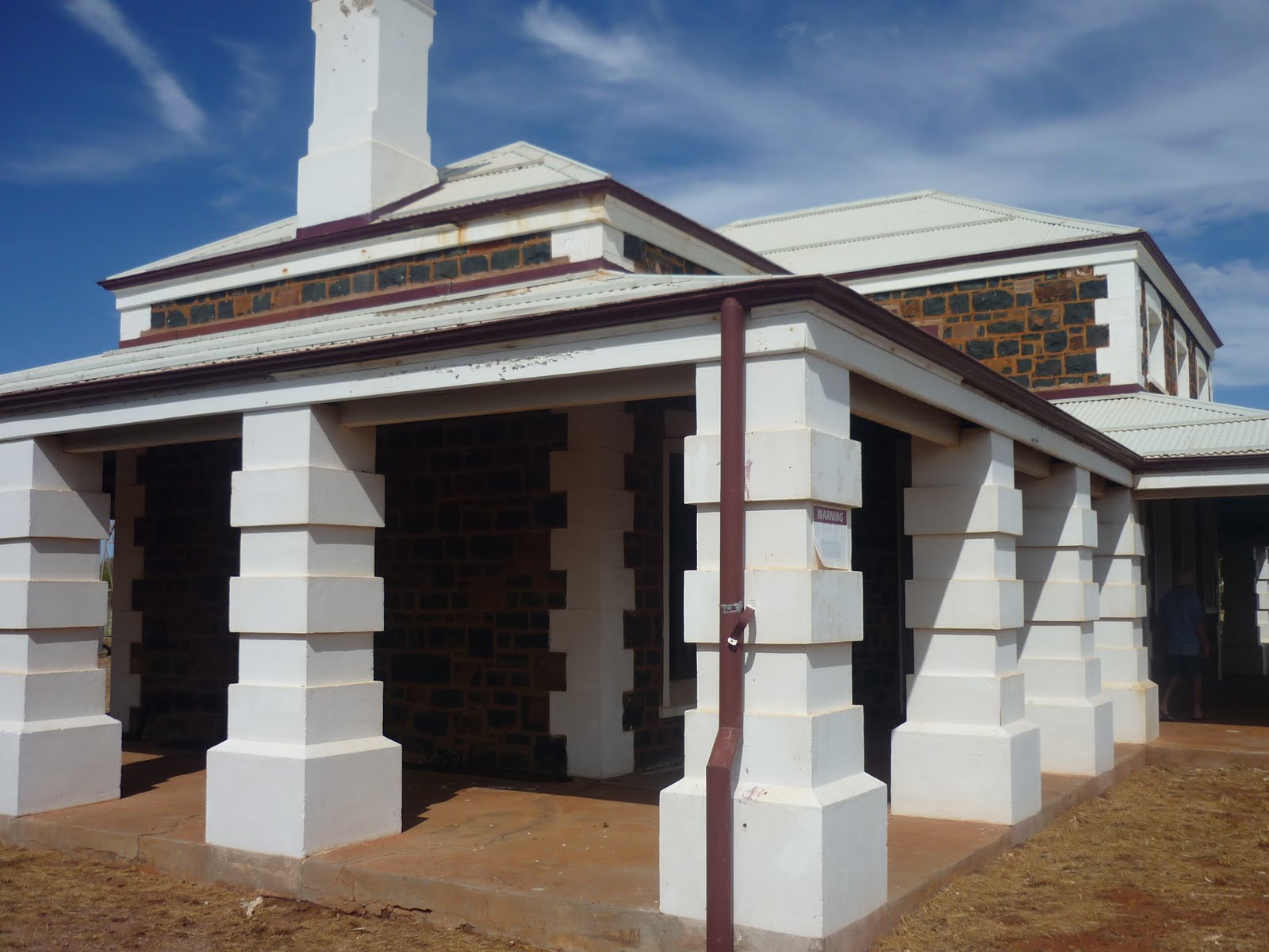
Karijini Visitor Centre 
A plaque explaining the shape of the building 
A horse and rider made out of steel

Next we stopped at Weano Gorge and we actually climbed down to the bottom of the gorge and had a paddle in the waters.  There are lots of walks you can do ranging from easy to extremely hard with lots of warning signs which tell you of the dangers of unstable rocks and hypothermia from the very cold waters.  The escarpments of the gorges are amazing.

Looking into Weano Gorge 
Peter at the bottom (the going down was easier then the climbing back up!) 
One of the pools at Weano Gorge

Then we stopped at Oxer Lookout and Junction Pool.  This is where four gorges meet and is quite spectacular.  The lookouts are a bit scary as they hang right out over the gorge but the views are incredible.  There was a memorial here for a rescuer that lost his life trying to save someone who got caught in a flash flood.

Memorial to a rescuer who died trying to save a tourist 
Looking down into Junction Pool  at Red Gorge from Oxer Lookout

Wittenoom Gorge 
Hancock Gorge

Next stop was Knox Gorge with more amazing scenery and last but not least Joffre Gorge Lookout.  We watched a couple who had climbed down into the gorge trying to work their way out again.  It was very hot so we didn't have the energy to do any more climbing.

Knox Gorge 
Joffre Gorge from the lookout

Karijini National Park in the Hamersley Range is spectacular and a must see for anyone who comes to WA.

After tea we went for a walk around the loop and enjoyed the spectacular starry night sky with no interference from lights so all the stars were really bright.  Then it was an early night.

Tomorrow we are off to Port Hedland.
cheers
Pete and Roz

Thursday, 21 April 2011

Day 44 Tom Price - 12/4/11

I forgot to mention that Tom Price was named after an American, Thomas Moore Price who was instrumental in the incepton of the Hamersley ventures and the discovery of the mountain of ore called Mount Tom Price. 


This morning we had to be at the Visitor Information Centre at 10am for the mine tour.  Unlike the Kalgoorlie tour, we didn't have to wear long sleeves and long pants as the only requirement was for closed in shoes.  We were given a hard hat and safety glasses for when we got out on the tour.
The Visitor Centre

The tour bus turned up on time and we set off for the mine.  The main mine was on Mt Tom Price and had actually taken away half of the mountain.  It was very similar to the superpit at Kalgoorlie but was no where near as busy as they actually had several mines on the go.  This mine was for iron ore.  It was a really interesting tour and we got to hop out near the mine for a closer look. 
When we got back from the tour we had lunch and then went for a drive to Paraburdoo mainly because I liked the sound of the name! 

Dump Trucks 
A special machine for lifting the huge tyres 
Dump truck coming back with a load of iron ore 
The guide giving a talk  
The Open Cut Mine at Mt Tom Price
The Lookout

Paraburdoo was another mining town constructed in 1970 to service the local mining industry.  We stopped at the shopping centre to get an ice cream and were amused to see some cattle in the local park.
Entry sign for Paraburdoo 
Artwork on one of the buildings 
Paraburdoo Golf Course 
The cattle in the park

On the way back we went a little way into Karijini National Park and went to a lookout.  We were surprised to see that the rocks around the lookout had been painted on with memorials.  It was quite bizarre.  There were even a couple that had proper plaques on them.
Memorials on the rocks 
One with a proper plaque 
Another with a plaque 
View from the lookout

Tomorrow we are going to camp in Karijini National Park.

cheers
Pete and Roz

Day 43 Karratha to Tom Price - 11/4/11

Today we are going to Tom Price and using the Pilbara Iron Access Road which is a dirt road that goes along beside the private railway owned by Rio Tinto that goes out to the mines at Tom Price and Paraburdoo.  There are bitumen roads to Tom Price but the access road is the most direct from Karratha.

The Pilbara Iron Access Road

In order to travel on this road you have to go to the Tourist Information Centre and get a permit.  Before they will issue you with the permit (which is free) you have to watch a video on the dangers of using this road.  Some of the conditions of travelling on this road are:
  • Maximum speed is 80 kmph
  • Headlights must be on
  • No overtaking (dangerous because you can't see if anything is coming for the dust:
  • Cannot stop on the road, you must pull off
  • Must be in 4x4 mode
I think the movie would put some people off especially when they show you several wrecked vehicles during the video.

After getting our permit we set off.  The road was in pretty good condition for a dirt/gravel road althought it was very dusty.  Not far out of Karratha we passed a very creative property sign and then entered the Millstream-Chichester National Park with rolling hills and spectacular escarpments.  There was one hill that Peter took a particular interest in for obvious reasons when you see the photo.  We also passed three iron ore trains.

A creative property name
Some of the flat topped hills 
Peter named this one "the nipple"
The entrance to Millstream-Chichester National Park
One of the trains, all I could fit into the frame

We were going along quite well, stopped for lunch and then the dust turned to mud as a water truck had just watered the road.  About four hours into the trip we then came into Karijini National Park which is WA's second largest national park covering in excess of 600,000 hectares.  The mountains and scenery was spectacular. 

A gorge in the Hamersley Range 
Views from a lookout 
Another View

Eventually we got to Tom Price and booked into the Tom Price Tourist Park which is the only caravan park in town and is at the base of Mt Nameless.  Tom Price was established in 1962 and was originally a closed mining town but is now an open town run by a shire.  Accommodation is very hard to get as the miners take up all the accommodation in the town.

Entry sign for Tom Price 
The dirty van - the spare tyre cover is usually white!

We went to the Tourist Information Centre and booked a mine tour for tomorrow.

cheers
Pete and Roz

Tuesday, 19 April 2011

Day 42 Roebourne, Wickham, Cossack, Point Samson - 10/4/11

Today we explored north of Karratha as we will be heading west to Tom Price when we leave Karratha so won't see this part.

First stop was Roebourne which has a population of 1400 and is 14kms from the coast on the Harding River.  Roebourne was established in 1866 and is the oldest town on the north west coast.  There are many restored historic buildings here including the old hospital, the post office, courthouse, gaol, Holy Trinity Church and the Union Bank.  Roebourne is considered the gateway to the Pilbarra region.  The Visitor Centre (housed in the old gaol) was closed until May so we didn't get to see the museum.  Roebourne is a "dry" town because of the problems with alcohol and the indigenous people and the one hotel in the town has been closed.

Roebourne 
The old gaol which is now a visitor centre and museum 
A dry wall fence

Just down the road we turned off to Cossack which is 11kms north of Roebourne.  Cossack used to be home to the north west's first pearling industry but due to the overfishing of the pearling grounds the pearling fleet moved further north and later became established in Broome.  This move, coupled with the building of a jetty at Point Samson in 1904 to accommodate larger ships, contributed to the decline of the town which was abandoned in 1950.  The historic town is now a popular tourist destination and a few restored heritage buildings give a glimpse of what life was like more than 130 years ago.  We went to the Tien Tsin lookout with fabulous views over the coastline and you could also see a clump of palm trees which used to be an afghan camp.


The general store 
A turtle sculpture

The court house 
View from Tien Tsin Lookout

A bit further on is Wickham which is a working port town established especially to service the needs of the growing mining industry in the 1970s.  It isn't a very big town so we were surprised to see that it has a Woolworths grocery store.  There was one of the mine dump trucks on display and it was really interesting to get up close and see how big they really are.

Entry to Wickham 
Peter beside the dump truck

Next stop was Port Samson which has a population of 400 and has sandy beaches sheltered by rock outcrops which form many secluded coves.  2kms off shore is the original lighthouse which was built in 1888 and is still intact.

Amazing coloured rock near Point Samson

Then it was back to the park as Peter had to pick up the gas bottles which had been refilled and another swim for me.

After tea we wandered down to the BMX track which is right next door to the caravan park.  There was a competition on and they had over 130 riders of all ages.  It was really exciting to watch the older riders battle it out on the track.

Tomorrow we are heading off to Tom Price.

cheers
Pete and Roz